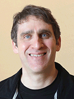
Satellite Imagery: From Space to the Field – Dr. Phil Townsend, University of Wisconsin-Madison
 The space age has come to the farm. Digital imagery – from satellites, drones and other devices – is becoming more readily available and easily accessible with each day.
Dr. Phil Townsend, University of Wisconsin-Madison, is working to turn this technology into a tool. His lab, in the Department of Forest and Wildlife Ecology, uses remote sensing to study ecosystems, including nutrient dynamics, physiology, and links between plants, insects, and the water cycle. Their work can have impacts for agriculture too.
Townsend said new technology – from the orbital level to handheld devices – can help farmers make decisions for their fields and crops. But, as is the case with all technological advances, it’s a work in progress. While many tools can capture images, accurately interpreting those images has some challenges.
For example, you could take a photo of a plant on a sunny day, but, when clouds roll in a few hours later, the plant may look entirely different due to the shift in light. Thus, it’s hard to make an accurate diagnosis on that one image. A technology called proximal spectroscopy could provide a solution. Townsend explained that a camera “looks up and down at the same time.” The user can compensate what the image shows with actual light conditions to align data, allowing comparisons to be made among multiple plants, fields, times, etc.
Townsend said he is optimistic about the use of satellite imagery in agriculture. Because they can collect a lot of data frequently, satellites can be used to help make yield predictions. He said they can get even more accurate if we can add in weather modeling. Other imagery tools can measure light quality and wavelengths to measure plant nutrients, photosynthesis, and more.
The key to capitalizing on all of this information is efficient data management, Townsend said. A farmer can invest in a drone and collect a lot of images of his or her fields, but it’s not a helpful decision-making tool if he or she cannot interpret the data. He said that’s the current phase of his research: find out how this technology can be practically applied.
Farmers don’t have to just “wait and see” this technology develop. Townsend said they play a critical role in the development process and can help researchers improve their work by sharing yield data and other information. Researchers can then match that information with their own images and data to improve modeling capabilities.
“Researchers are really dependent on interacting with farmers,” Townsend said.
| Category: |
Equipment Forage Foundations Technology and data management |

